Main takeoff: Cerro La Cumbre |
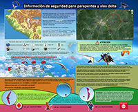
Iformation for all paragliders and hang gliders pilots
|
Coordinates |
19º10'52.62 "N 103º41'31.33" O |
Types of gliders |
Paragliders and hang gliders |
Possibilities during flight |
90% of the days of the year you can fly |
Best time to do Cross Country |
Winter (December to March) |
Size takeoff |
Big: 60m long x 25m wide (five wings) |
Recommended level |
Intermediate pilots (LTF 1-2) and advanced beginner pilots supervised or accompanied. |
Access to takeoff |
Easy, any small car arrives are 7.5 km asphalt road from Colima and 3.5 km of paved road up the hill. |
How to get |
First you must get to Colima to the "Hotel Costeno" located at: Boulevard Carlos de la Madrid Bejar # 1001, from'll drive south on the Colima-Jiquilpan road hotel, from the hotel to the rise of the summit are just 7.5 Km , there will turn right (south) and go up the hill of "La Cumbre" by a very good paved road are 3.5 km climb. The car reaches the shore takeoff, no need to walk almost nothing. The takeoff is near a temple that has a ceiling sculpture of the Virgin. |
characteristics |
The flight zone is mainly thermal, although there is a very steep hill and you can surf in the area, is recommended for intermediate pilots (LTF 1-2) to advanced, in winter there are strong thermal and should fly with caution, it is important to take off when the wind begins to enter South South-West since some days the wind gets stronger quickly.
On this site national and international competitions are held and part of the Mexican National Paragliding Championship. |
Flight zone |
A see taking off is recommended to fly south and cross a rib of the hill, across the rib can be seen to the left (South-East) area surfing is the best to take up, especially when you do not know the flying. |
Piano and Landing |
Failure to cross the rib must fly west takeoff and crossing the river "El Salado" there is a large landing, there is another smaller landing heading south-west off the bottom of the rib, both have some turbulence.
If crossed rib, you will see the area in front of surfing many areas of agriculture, marked on the map Flight Zone are some common to land, access to the entrance of the village of Piscila. |
Prohibited areas |
This banned from flying to the north-east of the takeoff as is the National Airport of Colima "Lic. Miguel de la Madrid Hurtado" |
Map of the Forbidden Zone |
|
Cross Country Trails |
You can fly to West takeoff following the road to the hotel "The coastal" and follow the south of the city of Colima to the town "Rancho de Villa," and turn north to the village of "Comala" or south to the town of "Coquimatlan". |
Cross Country routes in "The Summit" |
|
Contact the
Paragliding Club Colima AC |
Tel: 01 + 312 + 3304444
( Alejandro, Nacho or Eduardo)
Cel 045-312-1139491 (Benjamin)
|


